Home › Our latest news › Portable radar speed sign a strategic tool for testing an area before permanent road improvements

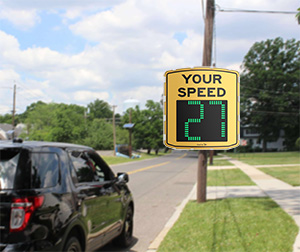
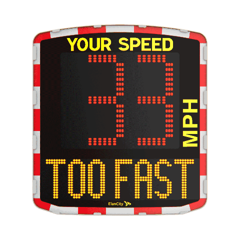
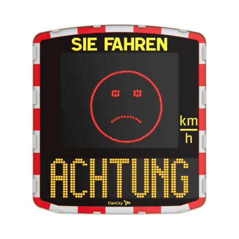
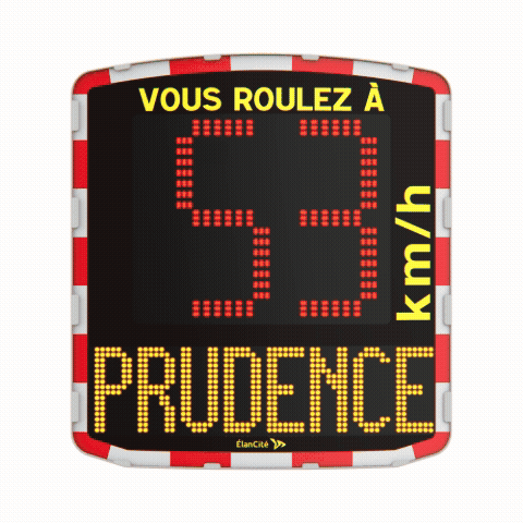
A portable radar speed sign is a compact device that utilizes advanced radar technology to measure vehicle speed and display it in real time. This allows drivers to instantly see their speed, encouraging compliance with posted speed limits. These signs are commonly deployed in residential areas, school zones, and construction sites to enhance traffic safety and support traffic calming initiatives.
Many portable radar speed signs are designed for convenience, being solar-powered, battery-operated, or fully portable. This makes them easy to set up using a trailer or sign dolly, eliminating the need for permanent installation.
Whether referred to as radar feedback signs, speed display signs, or simply speed signs, these systems are engineered to provide immediate feedback and improve driver awareness, contributing to safer roads for everyone.
Understanding how vehicles move through a road network and how drivers behave at different speeds is essential for designing safer streets and improving mobility for all users. This evaluation provides concrete evidence that planners can use to justify changes, prioritize interventions, and monitor the effectiveness of implemented measures over time.
The first step in evaluating traffic patterns and speed behavior is collecting reliable, localized data. This process typically begins with short-term or continuous traffic counts, often conducted using radar-based speed sensors, camera-based counters, or in-situ manual observations.
These counts capture the number of vehicles, pedestrians, and sometimes cyclists that pass a specific location during defined time periods, such as morning and evening peak hours, midday, and weekends.
To obtain a representative picture, data collection should span several days or weeks, including weekdays and weekends, to account for variations in travel demand. Planners may also use automatic vehicle classifiers to distinguish between cars, trucks, motorcycles, and buses, allowing for a more nuanced understanding of traffic composition. When combined with geospatial data, these counts can reveal corridors with high traffic volume, congestion hotspots, and locations where vulnerable road users are particularly exposed.
In addition to quantitative counts, qualitative observations at intersections and along road segments can help uncover patterns such as frequent lane-changing, aggressive driving, or illegal maneuvers. These insights contextualize the numerical data and can inform decisions about intersection redesign, signage, and signal phasing. Together, the initial data collection forms the baseline against which proposed changes and their impacts will later be measured.
Assessing Impact of Speed on Road Safety
Speed is a critical factor in road safety, influencing both the likelihood and severity of collisions. Evaluating how current speed behavior affects safety begins by analyzing speed distribution data collected at key locations, such as intersections, mid-block segments, and school zones.
Planners typically look at metrics such as the 85th percentile speed, mean speed, and speed variance to understand how most drivers behave and how diverse those behaviors are.
Research consistently shows that even small reductions in average speed can lead to substantial decreases in crash risk and injury severity. For example, reducing vehicle speeds from 50 km/h to 30 km/h in urban areas can significantly lower the probability of pedestrian fatalities in the event of a collision.
This relationship is integrated into collision prediction models and risk assessment tools that help planners estimate how proposed changes—such as narrower lanes, raised crossings, or traffic calming measures—would affect safety outcomes.
By overlaying speed data with historical crash records, planners can identify segments where high speeds coincide with frequent collisions, particularly those involving vulnerable road users. Targeted countermeasures, such as speed humps, chicanes, or enhanced signage, can then be prioritized at these locations. Moreover, changes in speed behavior following the implementation of such measures can be monitored over time to verify their effectiveness and refine the design as needed.
Road safety trials act as a critical bridge between innovation and implementation, enabling agencies to test new treatments under real-world conditions before committing to large-scale rollouts. By incorporating cost-effectiveness directly into the trial design, practitioners can ensure that limited budgets are allocated to measures that deliver the greatest safety gains per dollar spent.
This strategy aligns with international guidelines on cost-benefit analysis in road safety, which emphasize prioritizing measures that significantly reduce crashes and injuries while maintaining acceptable costs. Identifying the most efficient use of resources is key to achieving impactful outcomes.
One of the main benefits of road safety trials is their ability to minimize financial risk by limiting initial investments to a manageable scale. Instead of retrofitting an entire network, agencies can deploy prototype treatments at a small number of representative sites, effectively controlling both capital outlays and ongoing maintenance costs. This phased approach allows for a thorough evaluation of safety outcomes and operational performance without risking large-scale budget failures.
Effective trial management further reduces the risk of costly rework. By establishing clear performance indicators at the outset and incorporating protocols for early termination if the treatment underperforms, organizations can quickly redirect funds to more promising interventions.
Standardized cost-benefit and cost-effectiveness procedures—such as best- and worst-case sensitivity analyses—help quantify uncertainties and ensure decisions are grounded in transparent, evidence-based estimates rather than overly optimistic assumptions.
Road safety trials provide significant flexibility in both location and timing, allowing agencies to tailor implementations to local conditions and program priorities. Trial sites can be chosen from diverse environments—urban corridors, rural intersections, regional highways, or even local roads with municipal consent—ensuring findings are representative of the broader network where the treatment may eventually be adopted.
This geographic flexibility enables more generalizable conclusions and supports context-specific adaptations, such as integrating new technologies on regional roads or piloting low-cost signage changes in high-risk urban areas.
Equally important is the temporal flexibility of trials. They can be staged seasonally, aligned with peak traffic patterns or specific behavioral trends, or scheduled alongside other infrastructure projects to minimize disruption. Short-term or phased trials, like those used in smarter-highway technology pilots, allow rapid iteration and adaptation based on real-time feedback.
This modular approach enables agencies to address emerging safety issues, incorporate new data sources, and adjust trial protocols as conditions evolve—all without committing to long-term, inflexible contracts or designs.
Modern infrastructure planning is increasingly shifting from intuition-based choices to evidence‑driven strategies. By integrating reliable data into the planning process, cities and regions can move beyond generalized assumptions and focus on the specific needs of their communities. This alignment between data and decision‑making improves the likelihood that new roads, transit systems, utilities, and public spaces will meet actual demand and deliver measurable benefits to residents.
Data‑driven decision‑making transforms how local governments prioritize infrastructure projects. By analyzing traffic patterns, population growth, asset condition, and usage statistics, planners can identify which corridors or systems require immediate upgrades and where investments will yield the highest returns. This approach not only improves efficiency and reduces costs but also helps authorities demonstrate to residents that decisions are grounded in evidence rather than politics or anecdotal impressions.
In addition, data enables more precise forecasting of future needs. For example, mobility data can reveal how travel behavior is changing over time, allowing planners to anticipate shifts toward transit, cycling, or shared‑use vehicles.
When combined with environmental and climate risk data, infrastructure choices can be designed to be more resilient and sustainable, reducing long‑term maintenance burdens and protecting communities from extreme weather events.
Even the most robust datasets cannot fully capture the lived experiences of residents. Community feedback provides critical context that helps decision‑makers understand how proposed projects will affect neighborhoods, safety, and quality of life.
Structured engagement—through surveys, digital platforms, and participatory workshops—allows jurisdictions to collect diverse perspectives and detect trade‑offs that may not be visible in charts or maps.
Agile planning processes use this feedback to refine designs and timelines in real time. When residents report concerns about access, noise, or construction impacts, planners can adjust routes, schedules, or mitigation measures to minimize disruption. Establishing ongoing feedback loops also permits monitoring after construction, so that agencies can see whether services have improved and whether any unforeseen issues require further intervention.
This continuous dialogue strengthens public trust and ensures that infrastructure strategies remain responsive to evolving community needs.
In conclusion, this article has highlighted the importance of staying informed and taking proactive steps in daily life. From making conscious choices to embracing sustainable habits, every decision counts. By integrating these practices, individuals can significantly improve their quality of life while contributing positively to the environment. Small changes, when adopted consistently, can lead to substantial impacts over time. It is essential to act now, as delaying can reduce opportunities for meaningful progress. Take the first step today—start today, stay committed, and inspire others to join in creating a better future together.
A portable radar speed sign is a battery-powered, movable device that uses radar to detect and display approaching vehicle speeds on an LED screen. Its primary purpose is to alert speeders to slow down. Additionally, it serves as a tool to test areas before permanent road improvements by collecting speed data for analysis and identifying high-risk locations.
Portable radar speed signs offer real-time speed feedback, effectively reducing speeds by 10-40% in areas such as school zones and work sites. They improve compliance rates by 30-60%, enhancing safety without the need for enforcement. These devices are solar-powered, easy to install, and capable of collecting data, making them valuable for planning before implementing permanent changes.
Portable radar speed signs are highly effective, reducing speeds by 1-11 mph during deployment, with some cases showing lasting effects for up to 1 year. They also collect real-time data by location and time, which can be used to justify permanent improvements such as new signs or enforcement measures.